
Destinations
Nubra Valley and the Cold-Desert Dunes: Driving the Khardung La Route
Over Khardung La and down into Nubra - the sand dunes at 3,000 m, the route, and where to camp on the Shyok.
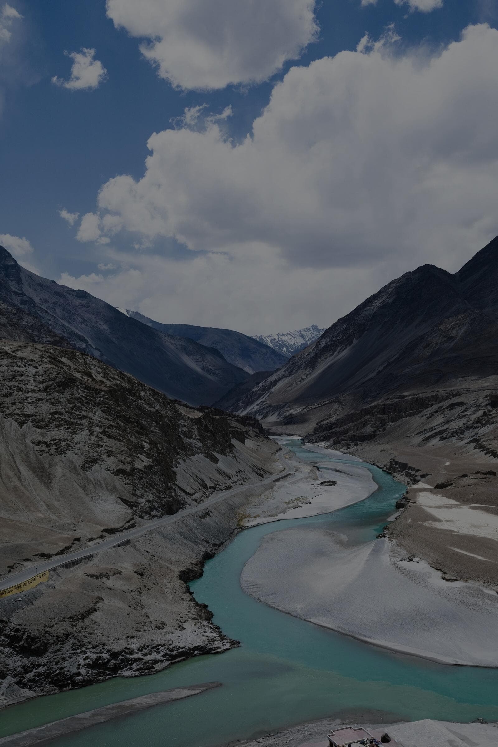
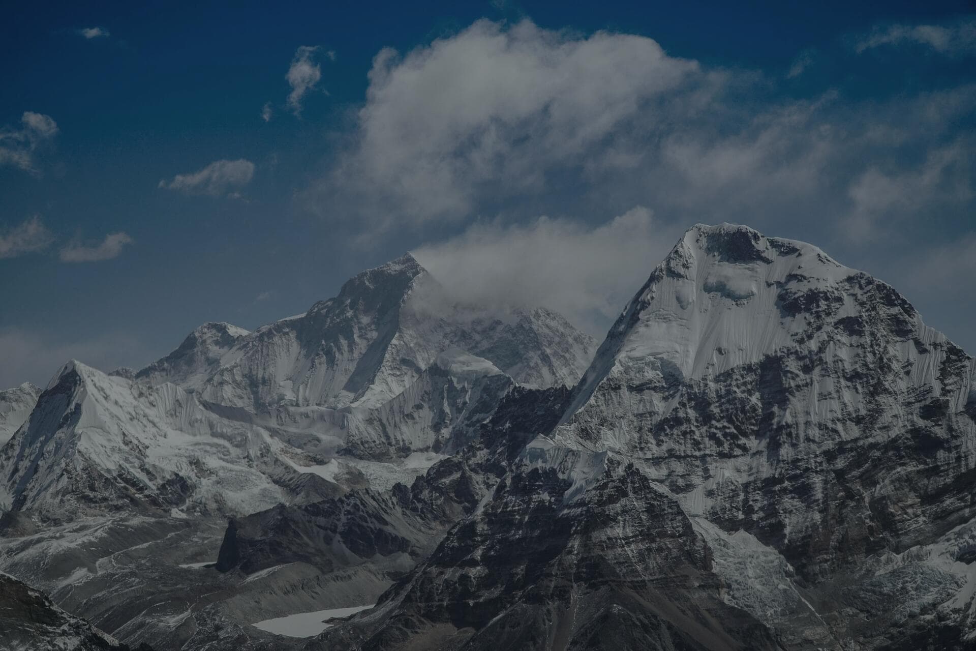
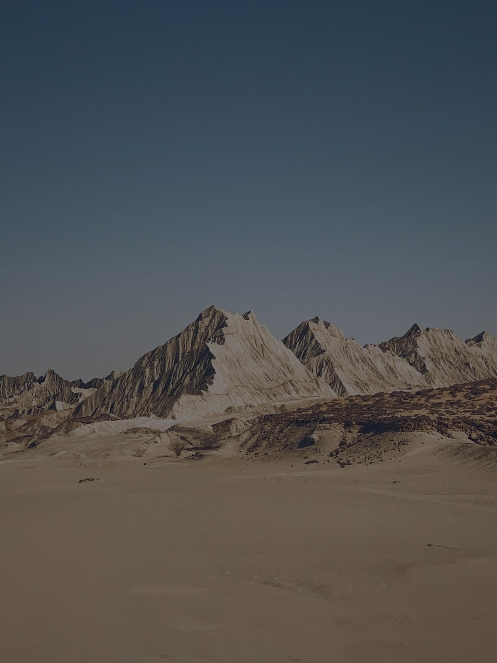
Nubra Valley is the cold desert north of Leh, reached by crossing Khardung La at 5,359 m and descending to the Shyok and Nubra river confluence at around 3,000 m, where you find genuine sand dunes and Bactrian camels. The drive from Leh to the dunes at Hunder is about 120 km and takes 4 to 5 hours because of the pass, not the distance. You need an Inner Line Permit (arranged in Leh in a few hours) and, critically, you should already be acclimatised in Leh for at least two nights before attempting Khardung La. We take groups over this route every season, and the combination of a 5,359 m pass in the morning and sand dunes by afternoon is one of the most surreal day's driving anywhere in India.
The thing that makes Nubra unlike anywhere else is the sheer compression of extremes in a single day. You leave Leh at around 3,500 m, climb to 5,359 m where the air holds little more than half the oxygen of sea level and there can be ice on the road in July, and then descend to a valley floor at 3,000 m where the afternoon sun is warm enough for shirtsleeves and the wind carries sand off real dunes. Bactrian camels - the twin-humped, shaggy descendants of the old Silk Route caravans - graze near Hunder. You can be photographing snow at the top of a Himalayan pass before breakfast and building a fire on a sand dune by dinner. That contrast is the whole appeal, and it is also the reason the trip demands respect: the pass that delivers you to the dunes is the highest most people will ever have driven, and it is unforgiving of anyone who arrives unacclimatised or in a hurry.
What is the Khardung La route actually like?
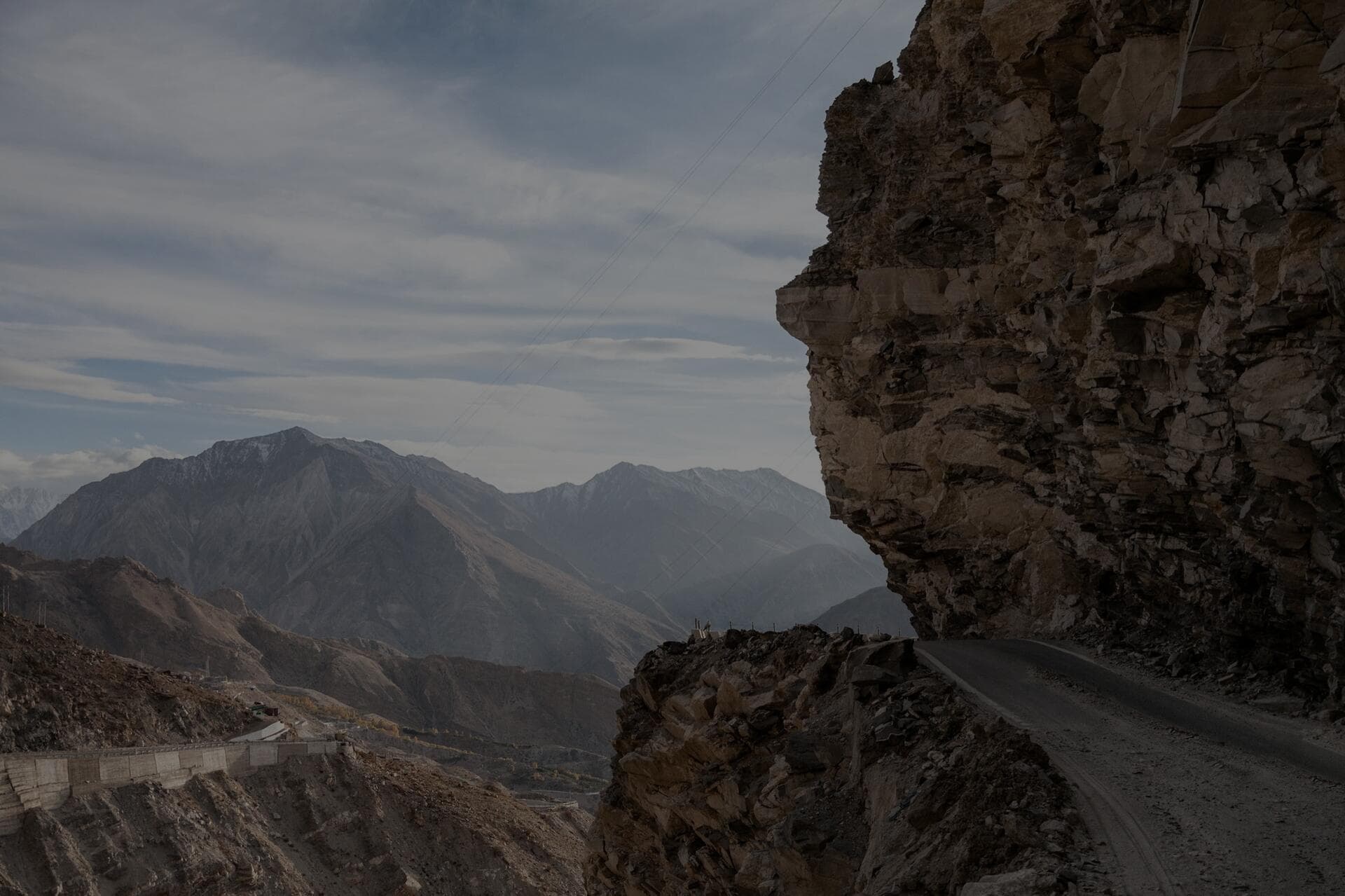
From Leh you climb steadily through South Pullu to the top of Khardung La at 5,359 m. The pass is paved in patches and broken in others, with the section between South Pullu and the top frequently churned to mud and meltwater by mid-morning. The army caps how long vehicles may stop at the top - do not linger, take your photo and descend, because standing around at 5,359 m when you arrived from 3,500 m that morning is exactly how people get hit by altitude. The north side down to North Pullu and Khardung village is rougher and has the worse water crossings. Once you reach the valley floor the road improves and follows the Shyok through Diskit to Hunder.
- Leh to Khardung La top: about 39 km, climbing to 5,359 m.
- Khardung La to Hunder dunes: about 80 km, descending to roughly 3,000 m.
- Total Leh to Hunder: about 120 km, 4 to 5 hours with the pass.
- Worst surface: the meltwater and mud between South Pullu and the top by late morning - cross early.
The single most useful tactic on this route is timing, and it comes down to one word: early. The stretch between South Pullu and the top is where snowmelt runs across the road as the morning sun works on it, and by late morning that surface is churned to mud, meltwater and slush by every vehicle ahead of you - a slick, rutted mess on a climbing hairpin. Cross it in the early morning while the melt is still frozen and the road is firm, and the same section is far more manageable. So leave Leh early, get over the pass before mid-morning, and you also avoid the queue of tourist taxis that builds at the top. On the north side down to North Pullu and Khardung village the road is rougher and the water crossings are worse, so keep your concentration on the descent rather than relaxing the moment you are over the summit - more rigs get into trouble on the broken, wet north side than on the climb. Once you are down on the valley floor following the Shyok through Diskit to Hunder, the road eases and you can finally breathe.
When is the best time to drive to Nubra?
June to September is the sweet spot, when Khardung La is reliably open and the valley is warm enough to enjoy the dunes (daytime 20 to 25 degrees C at Hunder, dropping near freezing at night even in summer). Khardung La can be cleared and open from around May to October, but shoulder seasons bring sudden snow that shuts the pass for hours or days. Winter Nubra is possible when the pass is open but it is a serious cold-weather undertaking with night temperatures well below -15C in the valley. For most overlanders, July and August give the most dependable crossing and the warmest camping.
Pin your plan to the season honestly rather than to a postcard, because Khardung La's weather is independent of how warm the valley looks. July and August give the most dependable crossing and the warmest dune camping, with Hunder days in the 20 to 25 degrees C range, though nights still drop toward freezing even at the height of summer - this is high cold desert, not a beach. The shoulders, late May into June and again in September into October, are quieter and beautiful but carry real risk of a sudden snowfall that closes the pass for hours or even days, so build a buffer day into any shoulder-season plan and do not pin a flight out of Leh to a tight return over Khardung La. Winter Nubra is genuinely possible when the pass is open, but it is a serious cold-weather expedition with valley nights well below -15C, untreated diesel that will gel, and a pass that can close without warning - not a casual trip, and not a first-timer's one. For most overlanders, aim for the high-summer window and keep slack in the schedule for the pass.
Where can you pitch a rooftop tent in Nubra?
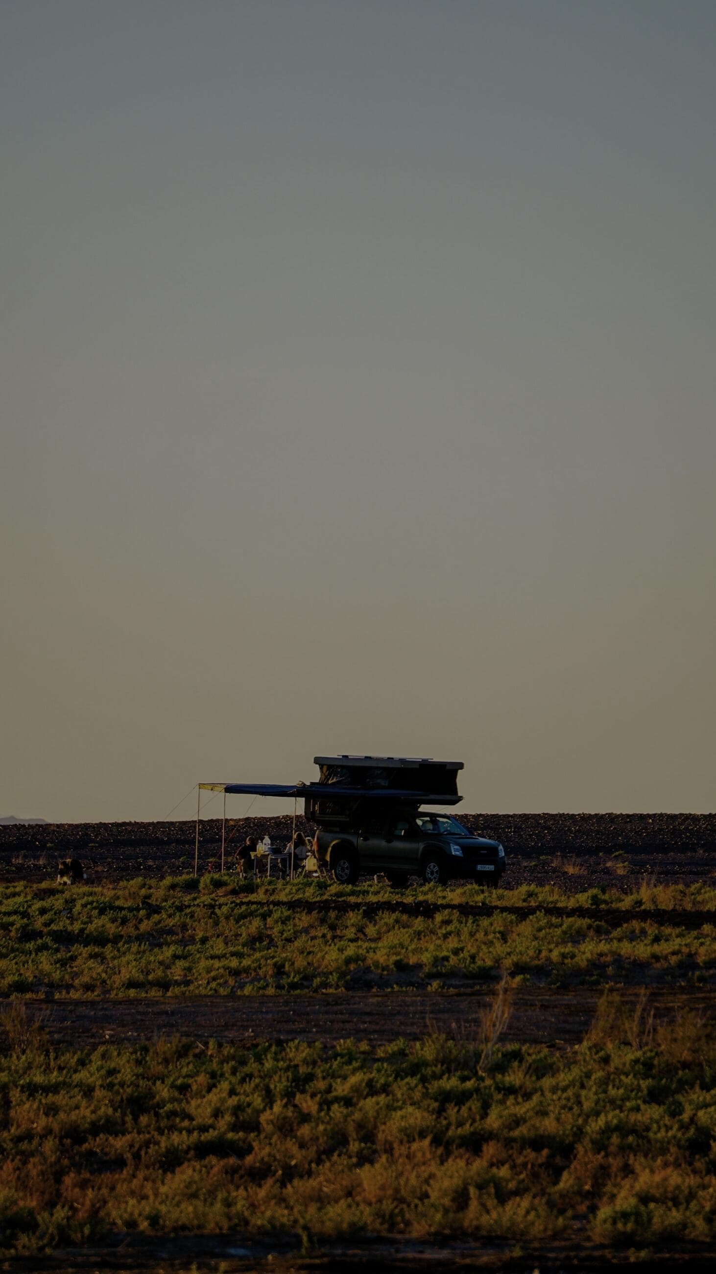
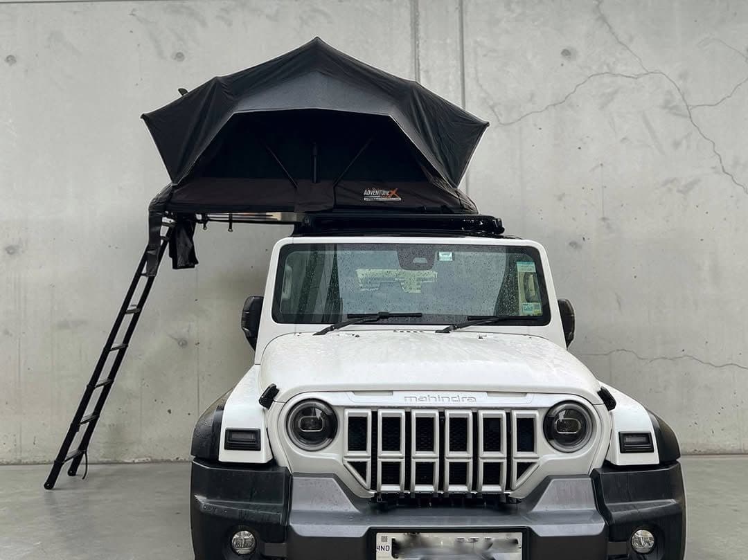
The best wild-feeling camping is on the gravel flats near Hunder and along the Shyok between Diskit and Hunder, where several designated and semi-formal campsites sit just back from the dunes. Do not drive onto or camp on the soft dune sand itself - it is both ecologically sensitive and a guaranteed bogging, and the wind reshapes it nightly. Park on the firm gravel apron at the dune edge, deploy the rooftop tent, and you wake to camels and sand at 3,000 m. The afternoon wind in Nubra is strong and sand-laden, so orient the vehicle nose-to-wind and zip everything; a sealed expedition tent like the Leopard41, with its tight DarkShield canvas, keeps the fine sand out far better than a loosely-pitched ground tent. There are also organised tented camps at Hunder and Diskit if you prefer fixed facilities.
The fine sand is the detail that decides where and how you camp, and it is relentless. Nubra's afternoon wind picks up grit and drives it into everything - it works into zips, into bedding, into the fridge seal, into your camera - and a loosely-pitched ground tent simply cannot keep it out the way a sealed rooftop tent can, which is exactly why we run a Leopard41 here. Pick your spot on the firm gravel apron at the dune edge, never on the soft sand itself: camping on the dune is ecologically sensitive, it is a guaranteed bogging when you try to drive off it, and the wind reshapes it nightly so what was flat at dusk is a slope by dawn. Orient the nose of the vehicle into the prevailing afternoon wind so the rig shelters your cooking and living area, deploy the tent before the wind peaks, and keep everything zipped and stowed. If you would rather have walls, a washroom and a fixed meal, the organised tented camps at Hunder and Diskit are a comfortable alternative and a sensible choice in a sandstorm. Either way, you wake to Bactrian camels and dunes at 3,000 m, which is worth a little grit in your tea.
How do you handle the sand and the altitude?
If you want to play on the firmer sand tracks around the dune fields, air down to 15 to 18 psi to float the tyres, keep momentum, and never stop on an incline in soft sand. Carry recovery boards and a compressor without exception - self-recovery in Nubra means digging and boards, because the nearest help can be an hour away. On altitude: the genius of Nubra is that you sleep low at 3,000 m, which actually aids recovery from the Leh altitude, but the crossing itself at 5,359 m is the highest most people will have driven, so go over it fresh in the morning, hydrate hard, and watch anyone with a headache or nausea closely.
Walk through the sand recovery so you are not improvising it solo in the wind. Air down to 15 to 18 psi before you head onto the firmer tracks - that longer contact patch floats the tyres instead of letting them knife into the soft stuff - and drive on momentum, smooth and steady, never jabbing the throttle and never coming to a dead stop pointing uphill, because starting again from a stop in soft sand is what buries you to the axles. If you do bog down, do not spin the wheels and dig yourself deeper; stop, clear the sand from in front of the tyres with the shovel, lay the recovery boards, and ease out gently. Carry the boards and a real 4x4 compressor without exception, because the nearest help in Nubra can be an hour away and self-recovery here means your own digging and your own boards. On altitude, use Nubra's geography to your advantage - sleeping low at 3,000 m genuinely helps you recover from Leh's altitude - but respect the crossing: go over Khardung La fresh in the morning, drink far more water than you feel you need, and keep a close eye on anyone in the group with a headache or nausea, ready to turn them back down if it worsens.
Nubra is the only place I know where you summit a 5,300 metre pass before breakfast and build a fire on a sand dune by dinner. Respect the pass and the valley gives you the rest.
What should you carry for the Nubra run?
Fuel first: Diskit has the only reliable pump in the whole valley, so fill in Leh, top up at Diskit, and carry a jerry can if you plan to push further north toward Turtuk (an open border village well worth the extra 80 km). Water is glacier-fed and should be filtered; we run a HydroX26 topped up in Leh. Permits must be carried in original with photocopies, as there are army checkposts at South Pullu and in the valley. And because Khardung La weather turns fast, carry warm layers in the cabin even on a hot day - it can be 25 degrees C at Hunder and snowing at the top of the pass the same afternoon.
- Fuel: fill in Leh, top up at Diskit (only reliable pump), jerry can if going to Turtuk.
- Sand kit: recovery boards, compressor, air down to 15 to 18 psi for soft tracks.
- Permits: Inner Line Permit in original plus copies for the South Pullu and valley checkposts.
- Layers: warm clothing in the cabin even on hot days, because the pass weather is independent of the valley.
Two of those carry extra weight on the Nubra run. Fuel discipline is non-negotiable because Diskit's pump is the only reliable one in the entire valley, and it can run dry or shut without warning - so fill completely in Leh, top up at Diskit regardless of how much you think you have, and carry a jerry can if you plan to push the extra 80-odd km north to Turtuk, the open border village near the Line of Control that rewards the detour with a different culture, apricot orchards and a real end-of-the-road feel. The other is layering, because Khardung La writes its own weather: it can genuinely be 25 degrees C and shirtsleeves at Hunder while it is snowing at the top of the pass the same afternoon, so warm clothing rides in the cabin within reach even on a hot day, never buried in the roof box. Add the glacier-fed water that should be filtered before drinking - we top up a HydroX26 in Leh - and the permits carried in original with photocopies for the checkposts at South Pullu and in the valley, and you have covered the things that actually catch people out on this route.
Frequently Asked Questions
Do you need a permit for Nubra Valley?
Yes. Indian citizens need an Inner Line Permit and foreigners a Protected Area Permit to cross Khardung La into Nubra. Both are arranged quickly in Leh through travel agents or the DC office, and must be carried in original with photocopies for the checkposts.
How high is Khardung La really?
Khardung La stands at 5,359 m. The old signboards claim 5,602 m, but GPS surveys put the true height at about 5,359 m. It is still one of the highest motorable passes in the world and demands proper acclimatisation in Leh first.
Can you drive a normal car to Nubra Valley?
A high-clearance car can make it in dry conditions on the paved sections, but a 4x4 is strongly recommended for the water crossings on the north side of Khardung La and the rough patches near the top. For playing on the sand tracks, a 4x4 with the ability to air down is essential.
How many days should you spend in Nubra?
Two to three days is ideal: one to get over Khardung La and reach Hunder, one to explore Diskit, the dunes and Turtuk, and a buffer day. Do not try to do Nubra as a single day trip from Leh; the altitude and distance make it exhausting and rushed.
Is the road to Turtuk worth the extra drive?
For most overlanders, yes. Turtuk sits about 80 km beyond Hunder near the Line of Control, an open border village with a distinct Balti culture, apricot orchards and the rare feeling of reaching the genuine end of the road. Carry extra fuel for the round trip, since the only reliable pump in the valley is back at Diskit, and allow most of a day for it.
Gear featured in this story
The kit named above, with current pricing - tap through for full specs.
Put it into practice
Headed this way? We run guided expeditions on these routes - permits, recovery and a mechanic all handled.