
Destinations
India's Highest Motorable Roads: Umling La and Khardung La Explained
Umling La at 5,799 m is now the world's highest motorable road. What to expect, and how it compares to Khardung La.
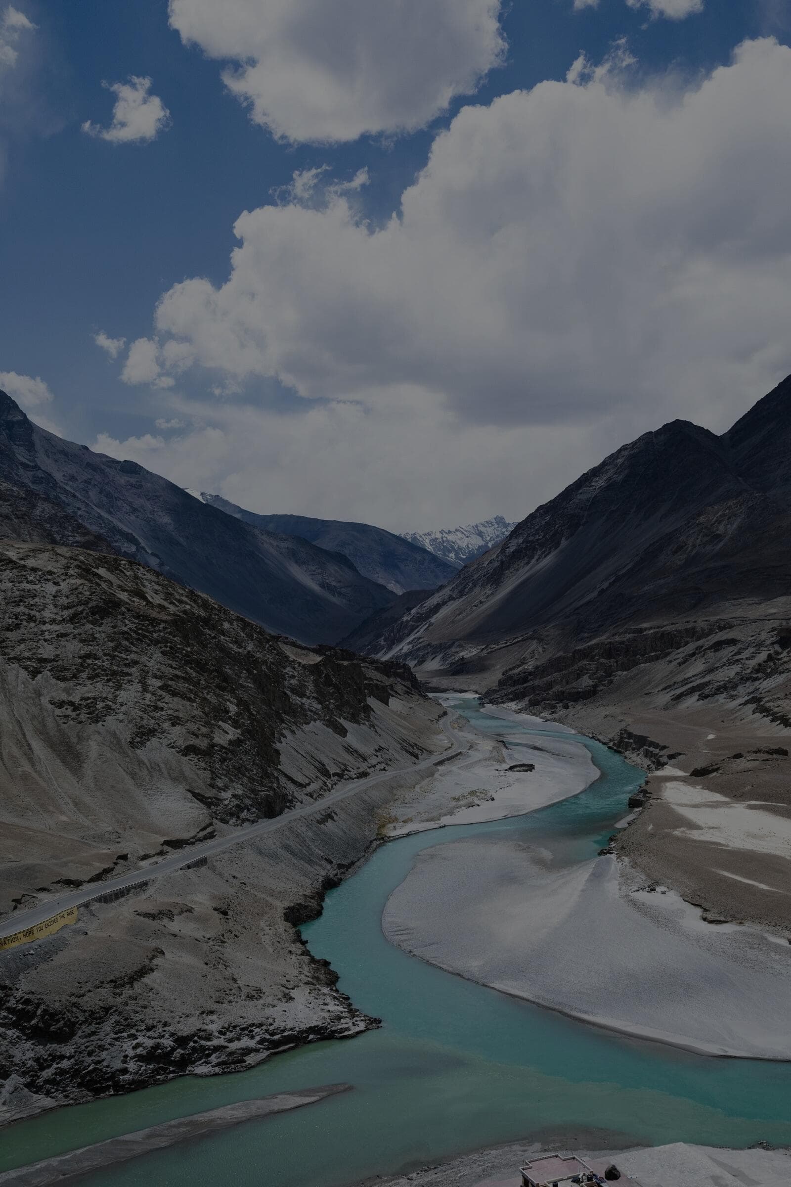
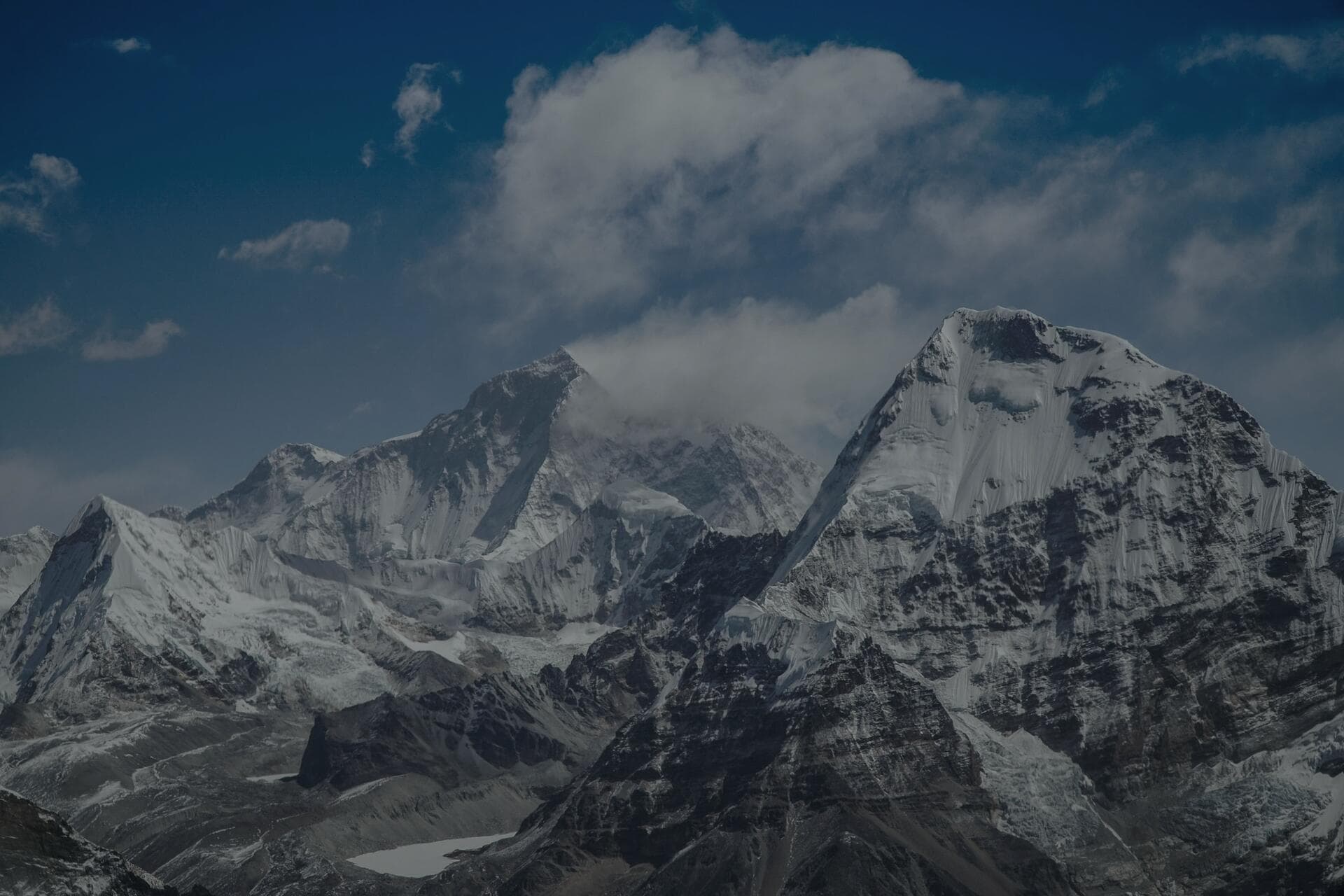
Umling La in eastern Ladakh, at about 5,799 m, is the highest motorable road in the world, built by the Border Roads Organisation and surfaced with tarmac right to the top - higher than Everest Base Camp. Khardung La, at 5,359 m near Leh, is the famous one most travellers tick off, but Umling La now sits roughly 440 m higher and is a far more remote, demanding objective. Both are real, drivable passes for a sound 4x4 with an acclimatised crew, but the air at 5,799 m holds barely half the oxygen at sea level, and that single fact governs everything about how you approach them. We have taken vehicles over both, and the difference between a memorable summit and an altitude emergency is entirely down to acclimatisation and how long you linger at the top.
How high is Umling La and what is it like?
Umling La tops out at about 5,799 m on the Hanle side of eastern Ladakh, reached via the remote Hanle and Photi La region. The astonishing thing is that the BRO has paved it, so the surface itself is good - the challenge is entirely the altitude and the remoteness. There is no fuel, no help and no shelter for long distances; Hanle, the dark-sky village famous for its observatory, is the nearest base, and even that sits at about 4,500 m. At the top, petrol and diesel engines lose significant power because there is so little oxygen, turbos work hard, and humans are on the edge of what is sustainable without supplemental oxygen. You drive up, you do not dawdle, and you get back down to a sleeping altitude that your body can handle.
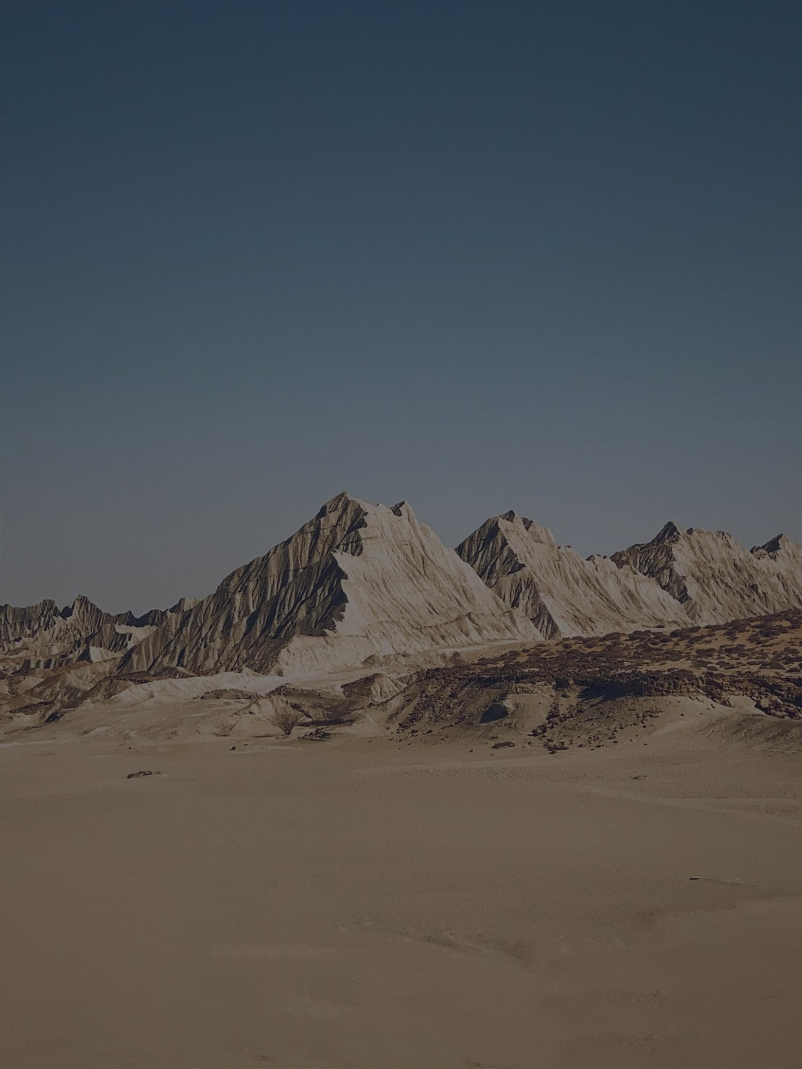
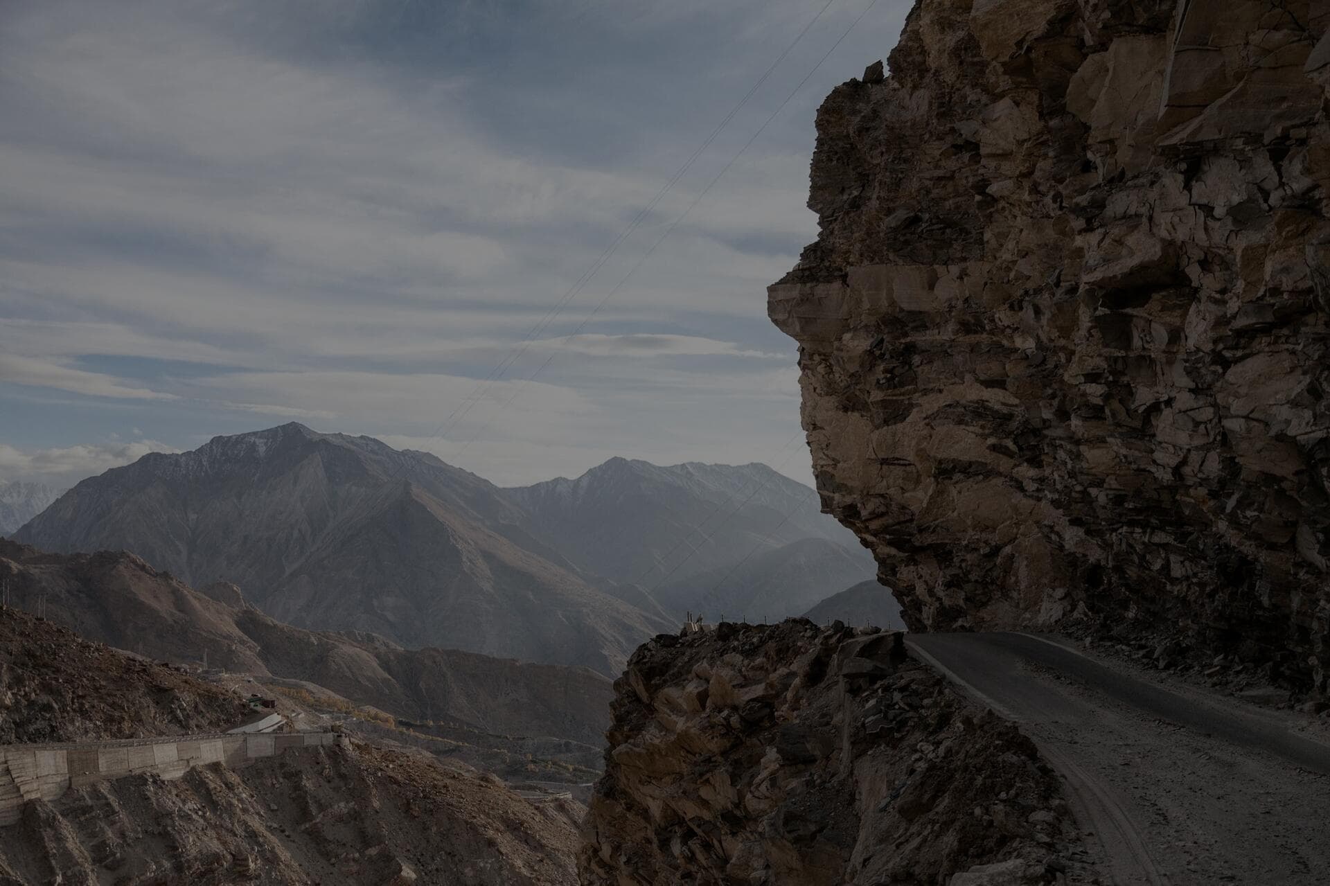
To put the geography in order: from Leh you run south-east to Hanle, a long day on increasingly thin and broken tarmac, sleeping at the observatory village at about 4,500 m. From Hanle the climb to the Umling La summit board is roughly 60 km of switchbacks over Photi La and the high plateau, much of it above 5,000 m the entire way, so you are already deep into oxygen-starved air long before the summit. The landscape up here is pure high-altitude desert - rust and ochre ridges, no trees, no grass, just wind and a sky that turns an almost violent blue. On our Ladakh Loop expeditions we treat the Hanle-to-Umling-La leg as the single most serious driving day of the whole trip, not because the road is technical but because you spend hours where a casual mistake compounds fast. Carry layers you can add without leaving the cab, because stepping out at the top into a 40 kmph wind at -10C strips heat out of you in seconds even on a sunny August morning.
How does Umling La compare to Khardung La?
Khardung La at 5,359 m is accessible, busy and just 39 km from Leh, with army posts, a cafe and other vehicles around - if something goes wrong, help is relatively near. Umling La at about 5,799 m is the opposite: higher, far more remote, lightly trafficked, and a genuine expedition to reach via Hanle. Khardung La is the one to cut your teeth on; Umling La is the one to attempt only after you are thoroughly acclimatised and confident at extreme altitude. Both demand the same respect for oxygen, but Umling La offers far less margin if you misjudge it. Think of Khardung La as the introduction and Umling La as the graduation.
- Umling La: about 5,799 m, the world's highest motorable road, paved, very remote, via Hanle.
- Khardung La: 5,359 m, near Leh (39 km), busy, with army posts and a cafe nearby.
- Difference in height: roughly 440 m, but a huge difference in remoteness and risk.
- Both: paved or part-paved surfaces - the real challenge is altitude, not the road itself.
- Order of attempt: Khardung La first to test yourself, Umling La only when fully acclimatised.
There is also a crowd difference that matters for safety. Khardung La sees hundreds of vehicles on a summer day - bikers, taxis, tour Innovas - which means that if your engine will not restart or someone collapses, another crew is minutes behind you. Umling La can give you the summit board entirely to yourself, which is glorious for photographs and genuinely dangerous for a recovery. We never run Umling La without a second vehicle on our Ladakh Loop precisely because self-recovery at 5,799 m, where bending to fit a recovery board leaves you gasping, is a different proposition to the same job at 3,000 m. If you are driving it independently, travel in a pair of vehicles and agree a simple rule before you start: if one stops, both stop.
What does extreme altitude do to you and the vehicle?
At 5,799 m the air pressure is about half that at sea level, so every breath delivers roughly half the oxygen. Humans feel it as breathlessness, pounding heartbeat, headache and impaired judgement - and impaired judgement is the dangerous part, because you may not realise how affected you are. Naturally aspirated engines lose power dramatically; even turbocharged diesels feel sluggish and can struggle to restart. Tyre pressures rise with the cold-to-altitude swing, and brakes and clutches work hard on the descent. The rule we drill into every crew: minimise time at the summit. Take your photo, check on everyone, and descend. Nobody should sleep anywhere near these altitudes, and the cure for almost any altitude symptom up here is to lose height fast.
On the mechanical side, a worked example helps. A 2.8L turbo-diesel that makes its rated torque at sea level can lose on the order of a third of its power by the time you are crawling the final ramps of Umling La, because the turbo can only do so much when the air it is force-feeding is already half as dense. That means more time in first and second gear, higher exhaust temperatures, and noticeably higher fuel consumption than the map distance suggests - we plan range up here at 25 to 30 percent worse than our highway figure. Petrol engines feel it even more sharply. Restart trouble is real: switch the engine off at the summit for photos and a tired battery plus thin air can leave you cranking nervously, so on extreme-altitude days we either keep the engine idling or park nose-down so we can roll-start if needed. Brakes deserve respect on the long descent back to Hanle - use engine braking in low gears rather than riding the pedal, because cooking the brakes on an hour of downhill at this altitude is how people lose them on the one section where you cannot afford to.
Your body is the more fragile machine. Expect a pounding pulse, a headache that builds within minutes of stepping out, and a strange clumsiness - dropping the lens cap, fumbling the zip. That clumsiness is the early edge of cognitive impairment, and it is exactly why we keep summit stops to ten or fifteen minutes. We watch each other for slurred speech and odd behaviour, because the affected person is usually the last to notice. Anyone who is breathless at rest, confused, or stumbling does not get another photo - they get bundled into the cab and driven down.
How do you prepare for Umling La or Khardung La?
Acclimatisation is the entire game. Spend several nights in Leh at 3,500 m, then build up through Nubra and the eastern Ladakh villages before going near 5,799 m - rushing from Leh to Umling La in a day is asking for a serious emergency. Carry a pulse oximeter and check the whole crew; anyone with a saturation in the low 70s and symptoms should not continue up. Carry Diamox on a doctor's advice, hydrate relentlessly, and consider supplemental oxygen for Umling La. Fuel-wise, fill at every opportunity - Hanle and the eastern reaches have almost nothing, so carry jerry cans and plan your range with a generous buffer for the low-oxygen power loss that makes engines drink more.
A workable build-up before Umling La looks like this: two nights in Leh doing nothing strenuous, a Nubra leg where you cross Khardung La but sleep low at Hunder around 3,050 m, a night or two at Pangong or Tso Moriri to bank time above 4,000 m, then the run to Hanle and only then the summit push. That is roughly a week of graded altitude before you ever point the bonnet at the world's highest road, and it is the difference between a crew that enjoys the top and a crew that gets evacuated. The same pulse oximeter we carry on every trip is the tie-breaker on the morning of the push - if someone is sitting in the low 70s at rest in Hanle with a headache, they stay in the village while the rest go up, no debate.
- Build up over roughly a week: Leh, Nubra (sleep low at Hunder), Pangong or Tso Moriri, Hanle, then the summit.
- Carry a fingertip pulse oximeter and check the whole crew at Hanle before the push.
- Carry supplemental oxygen for Umling La and know how to use it as a bridge to descent.
- Fuel: top up at Leh and Nyoma, carry 20 to 30 litres in jerry cans for the Hanle sector.
- Plan range 25 to 30 percent worse than the map distance because thin air makes engines drink more.
At 5,799 metres the road is the easy part - the BRO paved it. The hard part is the half-empty air. Drive up, take your photo, and get down. The mountain does not care how far you came.
When are these passes open?
Both Umling La and Khardung La are summer objectives, broadly open from around May or June to September or October, snow permitting. Umling La, being higher and more exposed, has a shorter and less predictable window and can be shut by snow at any time even in summer. You also need the relevant permits for eastern Ladakh and the Hanle sector, arranged in Leh, and these border areas have checkposts. Go in the heart of summer for the best chance of a clear crossing, watch the weather obsessively, and always be willing to turn back - a high pass will still be there next year, and forcing it in bad conditions at these altitudes is how trips end badly.
- Open season: roughly May to October, with Umling La's window shorter and less reliable.
- Permits: required for eastern Ladakh and the Hanle sector, arranged in Leh.
- Carry a pulse oximeter and, for Umling La, consider supplemental oxygen.
- Fuel: carry jerry cans - Hanle and the east have almost no reliable pumps.
Timing within the day matters as much as timing within the season. Aim to be at the summit in the late morning, not the afternoon. Mornings are calmer and clearer; by early afternoon the wind builds and high-altitude weather can roll in fast, turning a benign summit into a whiteout. That means an early start from Hanle, which in turn means you are doing the hardest driving of the trip with the least sleep, at the highest altitude - all the more reason to have banked your acclimatisation in the preceding days. We also pad the schedule with a spare day, because the single best decision on a high pass is sometimes to sit in Hanle for twenty-four hours and let a weather window open rather than force a marginal one.
Frequently Asked Questions
What is the highest motorable road in the world?
Umling La in eastern Ladakh, at about 5,799 m, is the highest motorable road in the world, built and paved by the Border Roads Organisation. It is higher than Everest Base Camp and surpasses the previously celebrated Khardung La at 5,359 m by roughly 440 m.
Is Khardung La or Umling La harder to drive?
Umling La is harder overall, not because of the road surface, which is paved, but because of its greater height (5,799 m versus 5,359 m) and extreme remoteness with no nearby help or fuel. Khardung La is busier and just 39 km from Leh, making it the safer first attempt.
Do you need supplemental oxygen for Umling La?
It is not strictly mandatory if you are well acclimatised, but carrying supplemental oxygen for Umling La at 5,799 m is wise. The air holds about half the oxygen of sea level, and oxygen is valuable both as a safety margin and to treat anyone who develops altitude symptoms at the top.
Can a normal car drive to Umling La?
Because the road is paved, a high-clearance car can physically reach Umling La in good summer conditions, but the altitude saps engine power severely and the remoteness leaves no margin for breakdowns. A well-prepared 4x4 with extra fuel and a fully acclimatised crew is strongly recommended.
How long does it take to drive from Leh to Umling La?
Done properly it is not a day trip. Plan a long day from Leh to Hanle, sleep at the observatory village around 4,500 m, then make the summit push the next morning over roughly 60 km of switchbacks. Building in the acclimatisation days beforehand, the Umling La leg sits at the back end of a week-long eastern Ladakh loop, not a quick out-and-back from Leh.
Put it into practice
Headed this way? We run guided expeditions on these routes - permits, recovery and a mechanic all handled.