Destinations
Manali-Leh vs Srinagar-Leh Highway: Which Road to Ladakh Should You Drive?
Two roads into Ladakh, two completely different trips. A first-hand comparison of passes, acclimatisation and risk.
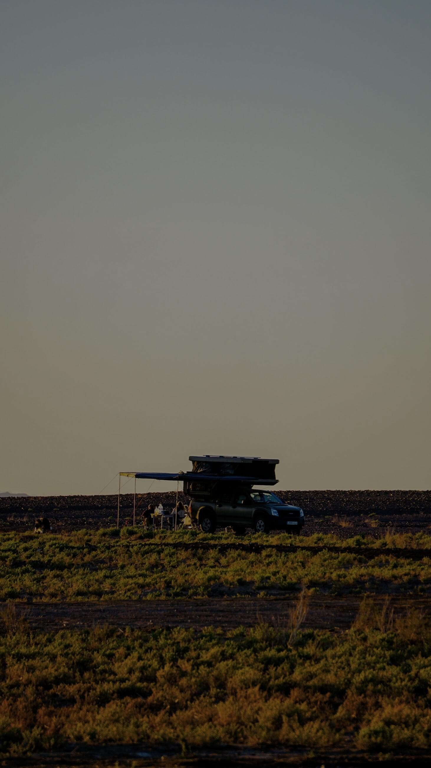
If your priority is acclimatisation and safety, drive into Ladakh on the Srinagar-Leh highway and exit on the Manali-Leh highway. The Srinagar side climbs gently - Srinagar sits at 1,585 m and you cross only two major passes (Zoji La at 3,528 m and Fotu La at 4,108 m) over two days, letting your body adjust before Leh at 3,500 m. The Manali side is brutal by comparison: it throws four passes above 4,900 m at you, including Taglang La at 5,328 m, often on the second day. Doing the loop in this direction - up the gentle road, down the high one - is the single best decision most Ladakh first-timers can make. We have lost count of how many trips we have run this way, and the altitude-sickness rate is a fraction of what we see on Manali-first itineraries.
How do the two highways actually differ?
The Srinagar-Leh highway is about 420 km and is the gentler, greener, more populated route. It passes Sonamarg, Drass (the second-coldest inhabited place on earth), Kargil and the moonscape of Lamayuru. Because villages and army posts line the whole road, help and fuel are never far. The Manali-Leh highway is about 470 km of high-altitude desert with long empty stretches, the famous Gata Loops (21 hairpins), the More Plains at 4,800 m, and four passes over 4,900 m. It is the more dramatic, more demanding drive and the one that bites people who have not acclimatised. Both roads are tarred for most of their length now, but both suffer washouts and water crossings, especially in the afternoon melt.
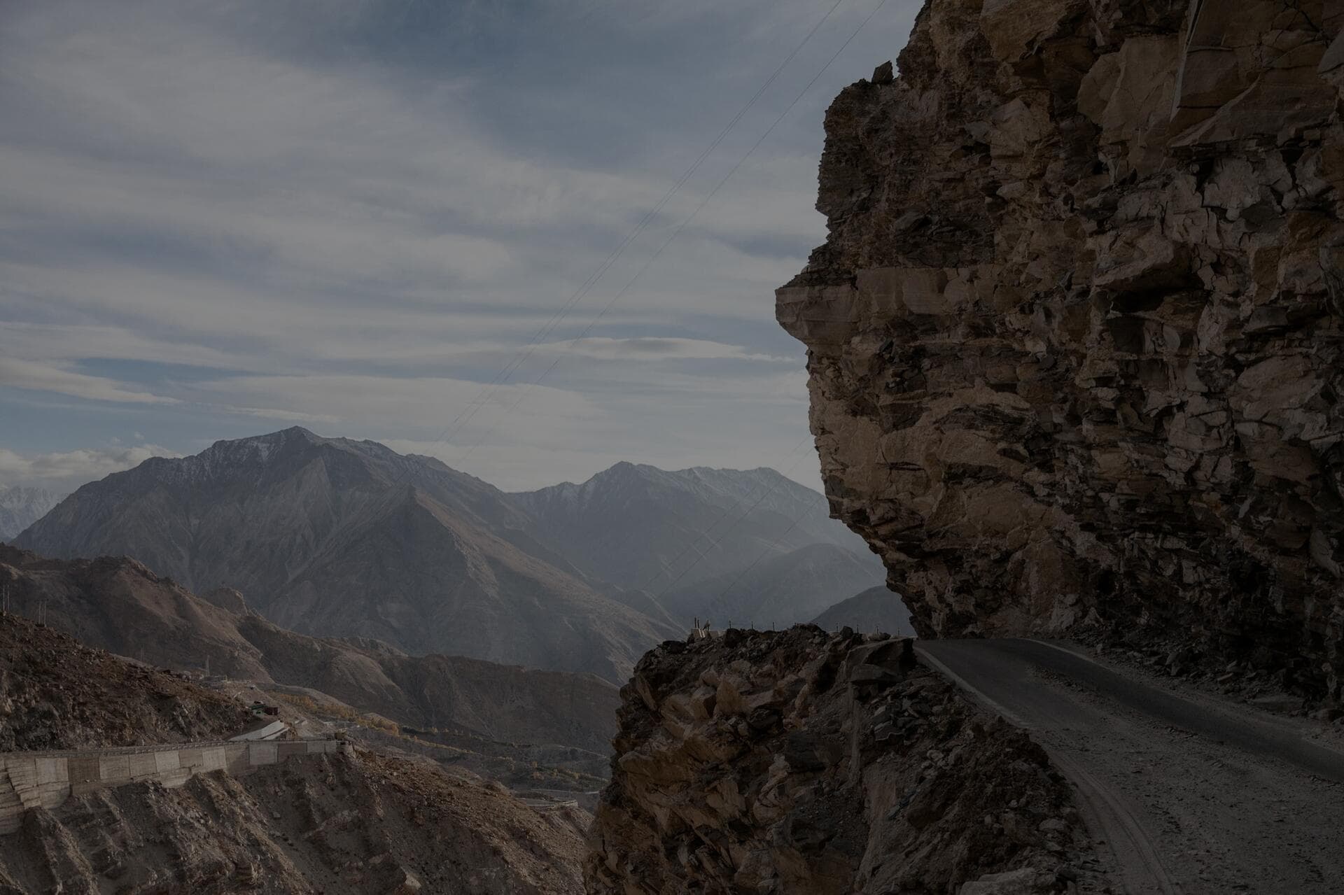
Name the passes, because they tell the whole story. On the Srinagar side you cross Zoji La at 3,528 m - a narrow, often muddy shelf and the genuine crux of that road - and Fotu La at 4,108 m, which is the high point and still under the altitude where most people get sick. On the Manali side you climb Rohtang or now the Atal Tunnel out of the Kullu valley, then Baralacha La at about 4,890 m, Nakee La and Lachulung La in the high desert, and finally Taglang La at 5,328 m before the run into Leh. That is four major passes near or above 5,000 m strung across a single road, several of them on the second day if you only take two - which is exactly why the body has no time to adapt if you start from Manali.
- Srinagar-Leh: about 420 km, 2 days, two major passes, gentle altitude gain, lots of fuel and help.
- Manali-Leh: about 470 km, 2 days, four passes over 4,900 m, long empty stretches, dramatic and demanding.
- Highest point Srinagar side: Fotu La, 4,108 m. Highest point Manali side: Taglang La, 5,328 m.
- Best practice loop: in via Srinagar, out via Manali, so altitude gain is gradual on the way up.
Which road is better for acclimatisation?
The Srinagar road wins decisively. Your sleeping altitudes climb in manageable steps: Srinagar 1,585 m, then Kargil at about 2,680 m, then Leh at 3,500 m. That is textbook acclimatisation - never sleeping more than about 1,000 m higher than the night before. On the Manali road your body goes from Manali at 2,050 m to a night at Sarchu (4,290 m) or Jispa, and Sarchu in particular is notorious because it is too high to sleep well before you have adjusted. If you must start from Manali, break the journey at Jispa (3,200 m) rather than Sarchu, and budget two nights, not one, before you tackle the big passes.
Sarchu deserves its bad reputation, so understand why. At 4,290 m it sits higher than Leh, yet it is where the two-day Manali itinerary naturally dumps you on night one, before your body has done any adapting at all - the worst possible combination of high sleeping altitude and zero acclimatisation. Crews who camp at Sarchu on the first night out of Manali are the ones we most often hear about waking with a pounding headache, vomiting, and a ruined trip. Jispa at about 3,200 m is the far smarter stop: it is roughly a kilometre lower, low enough to sleep reasonably on, and it leaves the big passes for a day when you are better adjusted. If the schedule allows, two nights on the Manali side before Taglang La beats one every time, which is another argument for saving this road for the exit when you are already acclimatised.
When are the highways open?
The Srinagar-Leh highway typically opens earlier, around late April or early May, and closes later, often into November, because Zoji La is cleared first. The Manali-Leh highway usually opens by late May or early June once the higher passes are cut through, and shuts by late October when the first heavy snow hits Baralacha La and Taglang La. The reliable common window for both is June to September. Note the Atal Tunnel now keeps the Manali-Keylong section open far longer and removes the Rohtang bottleneck, which has changed early-season planning on the Manali side.
The Atal Tunnel is the single biggest change to Ladakh road planning in years, so factor it in. By boring under the Rohtang ridge it removes the old Rohtang pass bottleneck - the permit queues, the traffic jams, the early closure when Rohtang snowed in - and keeps the Manali-to-Keylong section open and quick far longer into the shoulder seasons. What it does not change is everything beyond Keylong: Baralacha La and Taglang La are still high, still snowbound out of season, and still the gates that decide whether the through route to Leh is open. So the tunnel makes the lower Manali end more reliable and far faster, but the high desert passes remain the true season limiter, and the reliable common window for driving the whole loop is still June to September.
What does each road demand from the vehicle?
On the Manali road, the water crossings at Pagal Nala and near Whisky Nala are the classic stoppers, and they swell through the afternoon as the glaciers melt, so cross early in the day. The More Plains look benign but the soft shoulders swallow tyres that wander off the line. Carry recovery boards, a compressor to air down to 20 psi for the sandy plains, and a full spare - the gap between Keylong and Leh has almost no tyre help. On the Srinagar road, Zoji La is the crux: a narrow, often muddy shelf cut into the mountain that turns to a churned mess in rain and behind army convoys. Neither road is technically extreme for a stock 4x4 in the dry, but both reward a vehicle in good mechanical order and a driver who reads water and weather.
The single most useful habit on both roads is to do the hard bits early. Glacier-fed crossings like Pagal Nala are at their lowest in the cool of morning and swell through the afternoon, so a crossing that is an ankle-deep trickle at 8 am can be a churning thigh-deep torrent by 3 pm - cross early and you halve the difficulty. The same logic applies to Zoji La, which turns to a mud-churn behind army convoys and in afternoon rain; clear it in the morning before the traffic and the weather build. On the More Plains the trap is the soft shoulder, so stay on the established line, air down to about 20 psi to spread the load on the sand, and re-inflate afterwards. Carry a full-size spare and a plug kit on both roads, because the gap from Keylong to Leh has effectively no tyre help and a sidewall cut a long way from anywhere is a serious problem.
People think the danger on the Manali road is the height. The real danger is doing it on day one. Come up the Srinagar side first and the mountains stop fighting you.
Where do you refuel on each route?
On the Srinagar-Leh highway, fuel is comparatively easy: Sonamarg, Drass, Kargil and Khaltse all have pumps, so you rarely face more than 120 km between fills. On the Manali-Leh highway, the discipline returns - Tandi (near Keylong) has the last reliable pump before a roughly 365 km gap all the way to Leh, the longest fuel-less stretch in the region. Fill completely at Tandi, carry 20 to 30 litres extra, and do not gamble on the unofficial black-market fuel sold at inflated prices in Pang. We always cross-check our range against the next certain pump and add a 20 percent buffer for headwinds and low-gear climbing, which burns more than people expect.
- Srinagar side pumps: Sonamarg, Drass, Kargil, Khaltse - gaps rarely over 120 km.
- Manali side: fill at Tandi, then nothing certain for about 365 km to Leh - carry a full jerry can.
- Air down to about 20 psi for the More Plains and re-inflate for tarmac.
- Carry cash for both routes; card and UPI coverage is patchy once you leave the towns.
Do the range maths properly for the Tandi gap because it is where people get caught. Call it 365 km from Tandi to Leh, and remember your real-world economy on this road is worse than your highway figure: the constant climbing, the low-gear crawls over four high passes, and the thin air at altitude all push consumption up. A truck that returns a comfortable highway figure on the plains can drop 20 to 30 percent on this leg, so a tank that looks more than adequate on paper can come up short. Fill completely at Tandi, carry 20 to 30 litres in a jerry can, and add a buffer on top - the unofficial fuel sold at a markup in Pang is a last resort, not a plan. The same caution applies to cash: card and UPI coverage falls away the moment you leave the towns, so carry enough notes for fuel, food and emergencies across the whole route.
Frequently Asked Questions
Which is safer, the Manali-Leh or Srinagar-Leh highway?
The Srinagar-Leh highway is safer for first-timers because the gradual altitude gain sharply lowers the risk of acute mountain sickness. The Manali road is not dangerous in itself, but starting your trip on it, with four passes above 4,900 m on day two, is what causes most altitude emergencies.
How many days do you need to drive from Manali to Leh?
Take two days minimum, sleeping at Jispa or Sarchu, but three days is far better for acclimatisation. If you are doing the full loop in and out of Ladakh, budget 10 to 14 days to include Leh, Nubra and Pangong with proper rest days.
Do you need permits for the Manali-Leh and Srinagar-Leh highways?
No permit is needed for the highways themselves to reach Leh. Permits (Inner Line Permits for Indians, Protected Area Permits for foreigners) are required only for the border areas beyond Leh such as Nubra, Pangong and the Khardung La crossing, and are easily arranged in Leh.
Can you drive both highways as a loop?
Yes, and you should. The ideal Ladakh road trip enters via Srinagar for gentle acclimatisation and exits via Manali, or arranges a one-way vehicle. This way you experience both landscapes and only face the extreme Manali-side passes once you are fully adjusted to the altitude.
Has the Atal Tunnel changed the Manali-Leh drive?
Yes. The tunnel bypasses the Rohtang bottleneck, removing the old permit queues and traffic jams and keeping the Manali-to-Keylong section open and fast far longer into the shoulder seasons. It does not open the high passes beyond Keylong, though - Baralacha La and Taglang La still gate the through route, so the reliable window for the full loop remains June to September.
Put it into practice
Headed this way? We run guided expeditions on these routes - permits, recovery and a mechanic all handled.